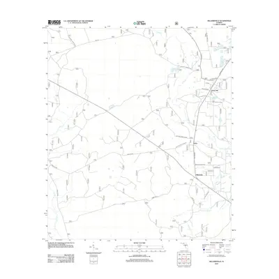
2012 Map of Hilliardville
USGS Topo · Published 2012About this map
Hilliardville sits within a network of forest roads and blackwater creeks in this 2012 survey. The landscape is defined by the hydrologic patterns of the Big Bend region, featuring numerous ponds such as Dog Pond, Sand Pond, and Lofton Pond alongside the winding Fisher Cr. The rural character is maintained through an extensive system of maintained routes like National Forest Rd 305 and Forest Rd 309, which provide access to the timberlands and natural springs of the area. Settlement is concentrated along Springhill Rd, linking the small communities of Helen and Spring Hill. This map reveals the transition between the pine flatwoods and the recreational areas centered around Trout Pond Recreation Area, highlighting the intersection of forestry management and local recreation in Wakulla County.
Find a feature on this map
35 named features on this map. Tap any name to fly to it.
Don’t see what you’re looking for? This feature index may not catch every label — zoom into the map to look around manually.
Map Details
Editions of this 2012 Hilliardville Map
This is the sole edition of this map. No revisions or reprints were ever made.
Other maps of this area

1940 · Tallahassee
USGS Topo · 1:62,500

1940 · Arran
USGS Topo · 1:62,500

1942 · Tallahassee
USGS Topo · 1:62,500

1943 · Arran
USGS Topo · 1:62,500

1943 · Tallahassee
USGS Topo · 1:62,500

1943 · Lake Talquin
USGS Topo · 1:62,500

1945 · Bradwell Bay
USGS Topo · 1:31,680

1954 · Tallahassee
USGS Topo · 1:250,000

1959 · Tallahassee
USGS Topo · 1:250,000

1960 · Tallahassee
USGS Topo · 1:250,000