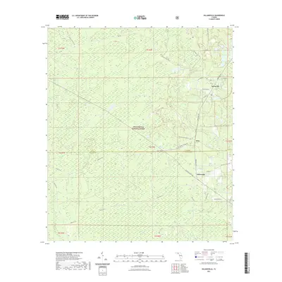
2021 Map of Hilliardville
USGS Topo · Published 2021About this map
The Apalachicola National Forest dominates this section of the Florida Panhandle, where the border of Leon and Wakulla County carves through a landscape defined by wetlands and pine flatwoods. The settlement of Hilliardville serves as a focal point along Springhill Rd, surrounded by a network of forest roads and trails including the Equestrian Trail - Main Loop Trl. This modern survey reveals a persistent rural character where small communities like Spring Hill and Helen are interspersed with numerous water bodies.
Find a feature on this map
116 named features on this map. Tap any name to fly to it.
Don’t see what you’re looking for? This feature index may not catch every label — zoom into the map to look around manually.
Map Details
Editions of this 2021 Hilliardville Map
This is the sole edition of this map. No revisions or reprints were ever made.
Other maps of this area

1940 · Tallahassee
USGS Topo · 1:62,500

1940 · Arran
USGS Topo · 1:62,500

1942 · Tallahassee
USGS Topo · 1:62,500

1943 · Arran
USGS Topo · 1:62,500

1943 · Tallahassee
USGS Topo · 1:62,500

1943 · Lake Talquin
USGS Topo · 1:62,500

1945 · Bradwell Bay
USGS Topo · 1:31,680

1954 · Tallahassee
USGS Topo · 1:250,000

1959 · Tallahassee
USGS Topo · 1:250,000

1960 · Tallahassee
USGS Topo · 1:250,000