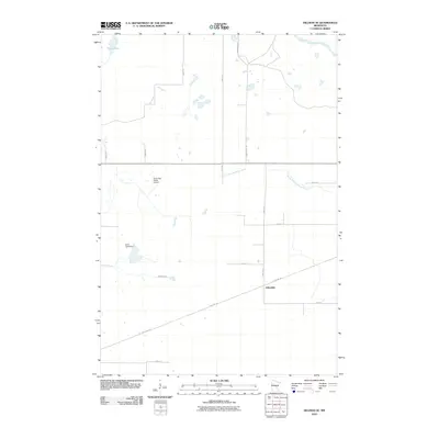
2010 Map of Hillman SE
USGS Topo · Published 2010About this map
Johnsdale anchors this rural landscape in Mille Lacs County, situated along the diagonal path of the Soo Line Trl. This corridor represents the legacy of the Minneapolis, St. Paul and Sault Ste. Marie Railroad, which once drove the local economy through timber and transport. The terrain is defined by a complex network of waterways, including the Rum River in the northeast corner and the winding North Fork Bradbury Brook, punctuated by small wetlands and the Kurtz Pond Dam. Local aviation is represented by the North Star Ranch Airport, located north of the primary road network of 170th Ave and 360th St. To the northwest, the map captures the edge of Skunk Lake, while Hillman Creek meanders through the central southern section, illustrating the low-lying, water-rich character of Bradbury Township.
Find a feature on this map
20 named features on this map. Tap any name to fly to it.
Don’t see what you’re looking for? This feature index may not catch every label — zoom into the map to look around manually.
Map Details
Editions of this 2010 Hillman SE Map
This is the sole edition of this map. No revisions or reprints were ever made.
Other maps of this area

1953 · Duluth
USGS Topo · 1:250,000

1953 · Stillwater
USGS Topo · 1:250,000

1955 · Stillwater
USGS Topo · 1:250,000

1958 · Stillwater
USGS Topo · 1:250,000

1958 · Duluth
USGS Topo · 1:250,000

1965 · Stillwater
USGS Topo · 1:250,000

1968 · Onamia NW
USGS Topo · 1:24,000

1968 · Ramey NE
USGS Topo · 1:24,000

1968 · Onamia
USGS Topo · 1:24,000
1968 · Platte Lake
USGS Topo · 1:24,000