
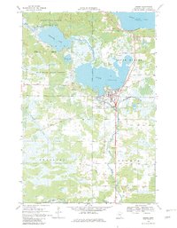
1968 Map of Onamia
USGS Topo · Published 1970About this map
Onamia sits at the southern gateway to the massive waters of Mille Lacs Lake, acting as a hub for both spiritual and civic life in the late 1960s. The settlement is anchored by the prominent Crosier Seminary and Holy Cross Church, with several nearby burial grounds including Mt Pleasant Cem and Holy Cross Cem serving local families. This survey captures a landscape defined by its complex hydrology, where the Rum River connects Shakopee Lake to Lake Onamia, winding through the preserved timber of the Mille Lacs Kathio State Park and Rum River State Forest. The Soo Line railroad cuts through the terrain, supporting the area's light industry and connecting the shoreline communities. Local landmarks like the Church Camp on the northern shore and the Landing Strip to the south reflect the region's development as both a religious center and a recreational destination.
Find a feature on this map
30 named features on this map. Tap any name to fly to it.
Don’t see what you’re looking for? This feature index may not catch every label — zoom into the map to look around manually.
Map Details
Editions of this 1968 Onamia Map
2 editions found
Other maps of this area

1953 · Duluth
USGS Topo · 1:250,000

1953 · Stillwater
USGS Topo · 1:250,000

1955 · Stillwater
USGS Topo · 1:250,000

1958 · Stillwater
USGS Topo · 1:250,000

1958 · Duluth
USGS Topo · 1:250,000

1965 · Stillwater
USGS Topo · 1:250,000

1968 · Onamia NW
USGS Topo · 1:24,000

1968 · Ramey NE
USGS Topo · 1:24,000

1968 · Milaca NE
USGS Topo · 1:24,000

1968 · Wahkon North
USGS Topo · 1:24,000