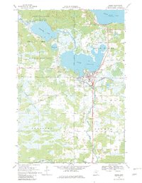
1968 Map of Onamia
USGS Topo · Published 1982About this map
Onamia serves as the focal point for this survey of the southern shore of Mille Lacs Lake, situated where the Rum River exits Lake Onamia. The town's institutional history is anchored by the Crosier Seminary and its associated Crosier Cem, alongside local infrastructure like the Hospital and Sewage Disposal plant. The landscape is a transition between the aquatic environments of Shakopee Lake and the managed timberlands of the Rum River State Forest and Mille Lacs Kathio State Park.
Find a feature on this map
34 named features on this map. Tap any name to fly to it.
Don’t see what you’re looking for? This feature index may not catch every label — zoom into the map to look around manually.
Map Details
Editions of this 1968 Onamia Map
2 editions found
Other maps of this area

1953 · Duluth
USGS Topo · 1:250,000

1953 · Stillwater
USGS Topo · 1:250,000

1955 · Stillwater
USGS Topo · 1:250,000

1958 · Stillwater
USGS Topo · 1:250,000

1958 · Duluth
USGS Topo · 1:250,000

1965 · Stillwater
USGS Topo · 1:250,000

1968 · Onamia NW
USGS Topo · 1:24,000

1968 · Ramey NE
USGS Topo · 1:24,000

1968 · Milaca NE
USGS Topo · 1:24,000

1968 · Onamia
USGS Topo · 1:24,000