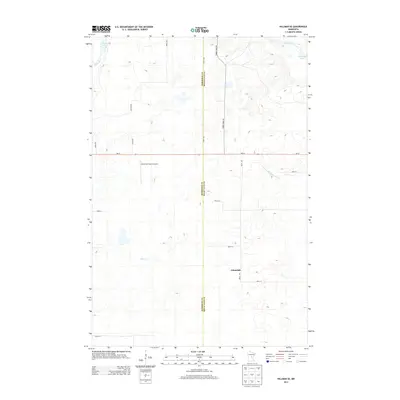
2013 Map of Hillman SE
USGS Topo · Published 2013About this map
Johnsdale and the surrounding woodlands of Mille Lacs County define this central Minnesota landscape, where the agricultural grid meets the wetlands and tributaries of the upper Rum River watershed. The terrain is crisscrossed by a network of rural routes, including Mn-27 and the long stretch of Timber Trail Rd, which navigate the many small depressions and lake basins typical of this glaciated region. In the northwestern portion of the map, the North Star Ranch Airport provides a point of aviation infrastructure amidst the low-lying waters of Skunk Lake and the Skunk River. To the east, the drainage of the N Fork Bradbury Brook and the edges of Shakopee Lake illustrate the area's complex hydrography, while Hillman Cr winds through the southwestern section, reflecting the quiet, rural character of the Mille Lacs and Morrison County borderlands.
Find a feature on this map
22 named features on this map. Tap any name to fly to it.
Don’t see what you’re looking for? This feature index may not catch every label — zoom into the map to look around manually.
Map Details
Editions of this 2013 Hillman SE Map
This is the sole edition of this map. No revisions or reprints were ever made.
Other maps of this area

1953 · Duluth
USGS Topo · 1:250,000

1953 · Stillwater
USGS Topo · 1:250,000

1955 · Stillwater
USGS Topo · 1:250,000

1958 · Stillwater
USGS Topo · 1:250,000

1958 · Duluth
USGS Topo · 1:250,000

1965 · Stillwater
USGS Topo · 1:250,000

1968 · Onamia NW
USGS Topo · 1:24,000

1968 · Ramey NE
USGS Topo · 1:24,000

1968 · Onamia
USGS Topo · 1:24,000
1968 · Platte Lake
USGS Topo · 1:24,000