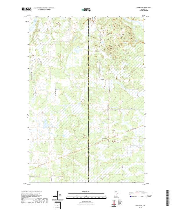
2022 Map of Hillman SE
USGS Topo · Published 2022About this map
Johnsdale stands as the primary settlement within this central Minnesota landscape, where the boundary between Morrison and Mille Lacs counties divides a terrain defined by extensive wetlands and watercourses. The northern reaches are shaped by the Rum River and Skunk River, while the N Fork Bradbury Brook and Hillman Creek drain the southern sections. This area reflects a shift from historical transport to modern recreation, most notably where the former rail corridor has been repurposed into the Soo Line South: Mille Lacs Trail and Soo Line South: Morrison Trail. The presence of the North Star Ranch Airport indicates the localized aviation infrastructure serving this rural region. The map provides a look at the modern land use patterns, showing how the grid of section lines and county roads interacts with the natural hydrology of Skunk Lake and its surrounding marshes.
Find a feature on this map
27 named features on this map. Tap any name to fly to it.
Don’t see what you’re looking for? This feature index may not catch every label — zoom into the map to look around manually.
Map Details
Editions of this 2022 Hillman SE Map
This is the sole edition of this map. No revisions or reprints were ever made.
Other maps of this area

1953 · Duluth
USGS Topo · 1:250,000

1953 · Stillwater
USGS Topo · 1:250,000

1955 · Stillwater
USGS Topo · 1:250,000

1958 · Stillwater
USGS Topo · 1:250,000

1958 · Duluth
USGS Topo · 1:250,000

1965 · Stillwater
USGS Topo · 1:250,000

1968 · Onamia NW
USGS Topo · 1:24,000

1968 · Ramey NE
USGS Topo · 1:24,000

1968 · Onamia
USGS Topo · 1:24,000
1968 · Platte Lake
USGS Topo · 1:24,000