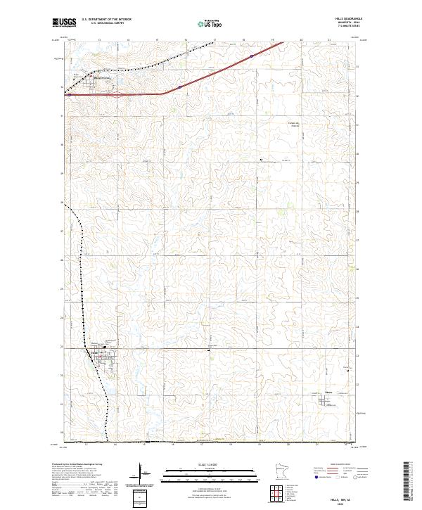
2022 Map of Hills
USGS Topo · Published 2022About this map
The southwestern corner of Rock County near the Minnesota and Iowa border reveals a landscape shaped by the Coteau des Prairies plateau and early agricultural settlement. This 2022 survey captures the small communities of Hills, Beaver Creek, and Steen, each serving as local hubs for the surrounding prairie farmsteads. The importance of community history is evident in the numerous cemeteries dotting the rural townships, including Beaver Valley Cem, Pleasant View Cem, and Flowerfield Cem. Religious life is anchored by institutions like the Dutch Reform Church and Bethlehem Cem. Natural drainage is provided by local waterways such as Mud Cr, Ash Cr, and Beaver Cr, which cut through the steady grid of county roads and section lines that define this pocket of the Upper Midwest.
Find a feature on this map
41 named features on this map. Tap any name to fly to it.
Don’t see what you’re looking for? This feature index may not catch every label — zoom into the map to look around manually.
Map Details
Editions of this 2022 Hills Map
This is the sole edition of this map. No revisions or reprints were ever made.
Other maps of this area

1955 · Sioux Falls
USGS Topo · 1:250,000

1958 · Sioux Falls
USGS Topo · 1:250,000

1967 · Valley Springs
USGS Topo · 1:24,000

1967 · Garretson East
USGS Topo · 1:24,000

1967 · Hills
USGS Topo · 1:24,000

1967 · Hills NE
USGS Topo · 1:24,000

1967 · Ash Creek
USGS Topo · 1:24,000
1967 · Luverne
USGS Topo · 1:24,000

1971 · Lester
USGS Topo · 1:24,000
1971 · Larchwood
USGS Topo · 1:24,000