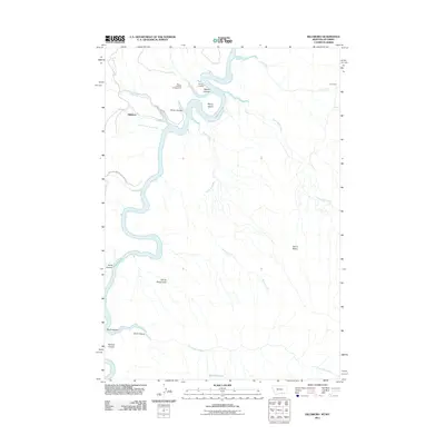
2011 Map of Hillsboro
USGS Topo · Published 2011About this map
Bighorn Lake dominates the central corridor of this survey, defining a landscape of deep canyons and seasonal drainages along the Montana-Wyoming border. The settlement of Hillsboro sits west of the water, connected by Barry's Landing Rd to the recreational facilities at Barrys Landing and the Barrys Landing Campground. This area is part of the Bighorn Canyon Natl Rec Area, where the rugged topography includes distinct features like Barrys Island and the complex drainages of North Fork Trail Creek and South Fork Trail Creek. To the east, the terrain rises toward Garvin Basin and the high plains, where isolated outposts like Cow Camp and geological curiosities such as the Natural Corrals and Devils Playground suggest a history of ranching and exploration in this remote borderland.
Find a feature on this map
23 named features on this map. Tap any name to fly to it.
Don’t see what you’re looking for? This feature index may not catch every label — zoom into the map to look around manually.
Map Details
Editions of this 2011 Hillsboro Map
This is the sole edition of this map. No revisions or reprints were ever made.
Other maps of this area

1954 · Billings
USGS Topo · 1:250,000

1955 · Cody
USGS Topo · 1:250,000

1957 · Billings
USGS Topo · 1:250,000

1958 · Billings
USGS Topo · 1:250,000

1958 · Cody
USGS Topo · 1:250,000

1962 · Cody
USGS Topo · 1:250,000

1964 · Two Point
USGS Topo · 1:24,000
1964 · Simmons Canyon
USGS Topo · 1:24,000
1964 · Little Finger Ridge
USGS Topo · 1:24,000
1964 · Dead Indian Hill
USGS Topo · 1:24,000