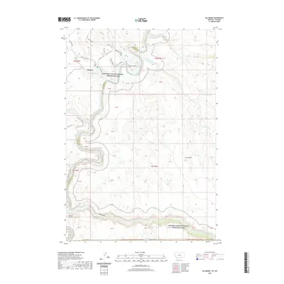
2020 Map of Hillsboro
USGS Topo · Published 2020About this map
Hillsboro serves as a central reference point in this corner of Carbon County, where the high desert plateau meets the deep incisions of the Bighorn Canyon National Recreation Area. The landscape is defined by dramatic geological shifts, from the broad expanse of the Garvin Basin to the sharp descent into Devil Canyon. Water management and natural drainage patterns are evident through features like East Reservoir and the winding course of Twentymile Creek, which carves through the eastern portion of the quadrangle.
Find a feature on this map
47 named features on this map. Tap any name to fly to it.
Don’t see what you’re looking for? This feature index may not catch every label — zoom into the map to look around manually.
Map Details
Editions of this 2020 Hillsboro Map
This is the sole edition of this map. No revisions or reprints were ever made.
Other maps of this area

1954 · Billings
USGS Topo · 1:250,000

1955 · Cody
USGS Topo · 1:250,000

1957 · Billings
USGS Topo · 1:250,000

1958 · Billings
USGS Topo · 1:250,000

1958 · Cody
USGS Topo · 1:250,000

1962 · Cody
USGS Topo · 1:250,000

1964 · Two Point
USGS Topo · 1:24,000
1964 · Simmons Canyon
USGS Topo · 1:24,000
1964 · Little Finger Ridge
USGS Topo · 1:24,000
1964 · Dead Indian Hill
USGS Topo · 1:24,000