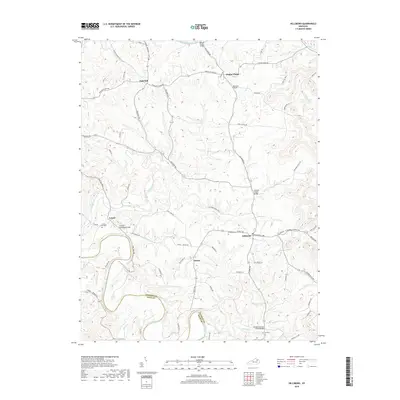
2019 Map of Hillsboro
USGS Topo · Published 2019About this map
The Licking River forms a significant portion of the southern boundary in this part of Fleming County, carving through a landscape defined by sharp ridge-lines and creek valleys. Several small crossroad communities like Hillsboro and Poplar Plains serve as anchor points for the rural road network, which includes family-named routes such as McKee Ln and Thurman Ln. For those interested in local history, the map documents numerous bridges and crossings including the Samuels Trestle Bridge and Graham Trestle Bridge. This edition records a terrain where life follows the natural contours, with agricultural land and small settlements like Locust and Sunset positioned along the higher ground of Locust Graveyard Hill or tucked into the bends of waterways like Locust Creek and Fox Creek. Several burial sites, including the Locust Graveyard and Hillsboro Cem, are preserved here, offering clear points of reference for genealogical research in this Kentucky region.
Find a feature on this map
79 named features on this map. Tap any name to fly to it.
Don’t see what you’re looking for? This feature index may not catch every label — zoom into the map to look around manually.
Map Details
Editions of this 2019 Hillsboro Map
This is the sole edition of this map. No revisions or reprints were ever made.
Other maps of this area

1929 · Salt Lick
USGS Topo · 1:62,500

1934 · Salt Lick
USGS Topo · 1:62,500

1951 · Hillsboro
USGS Topo · 1:24,000

1951 · Plummers Landing
USGS Topo · 1:24,000

1951 · Burtonville
USGS Topo · 1:24,000

1951 · Flemingsburg
USGS Topo · 1:24,000

1952 · Owingsville
USGS Topo · 1:24,000

1952 · Sherburne
USGS Topo · 1:24,000

1952 · Elizaville
USGS Topo · 1:24,000

1953 · Farmers
USGS Topo · 1:24,000