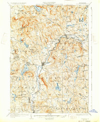
1929 Map of Hillsboro
USGS Topo · Published 1932About this map
The Contoocook River serves as the central artery for this part of southern New Hampshire, anchoring the industrial and transit hubs of Henniker and Hillsboro. In this 1920s landscape, the Boston and Maine Railroad follows the river's winding path, connecting the villages of Henniker Junc and Hillsboro Lower Village. A notable cultural landmark is the Birthplace of Franklin Pierce near the lower village, marking the regional history of the 14th U.S. President.
Find a feature on this map
144 named features on this map. Tap any name to fly to it.
Don’t see what you’re looking for? This feature index may not catch every label — zoom into the map to look around manually.
Map Details
Editions of this 1929 Hillsboro Map
5 editions found

Other maps of this area

1898 · Monadnock
USGS Topo · 1:62,500

1900 · Peterboro
USGS Topo · 1:62,500

1902 · Sunapee
USGS Topo · 1:62,500

1905 · Sunapee
USGS Topo · 1:62,500

1906 · Milford
USGS Topo · 1:62,500

1907 · Sunapee
USGS Topo · 1:62,500

1926 · Hillsboro
USGS Topo · 1:62,500

1927 · Concord
USGS Topo · 1:62,500

1927 · Penacook
USGS Topo · 1:62,500

1928 · Mount Kearsarge
USGS Topo · 1:62,500