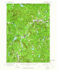
1957 Map of Hillsboro
USGS Topo · Published 1964About this map
The Contoocook River winds through the heart of this mid-century New Hampshire landscape, anchoring a series of mill-era villages and industrial hamlets. The Boston and Maine railroad tracks trace the river valley, connecting Henniker and Hillsboro, where concentrated development contrasts with the upland forest preserves. Numerous state-managed lands, including the Fox Research Forest and Harriman-Chandler State Forest, protect the high ground of Mt Hunger and Peaked Hill.
Find a feature on this map
145 named features on this map. Tap any name to fly to it.
Don’t see what you’re looking for? This feature index may not catch every label — zoom into the map to look around manually.
Map Details
Editions of this 1957 Hillsboro Map
3 editions found
Other maps of this area

1898 · Monadnock
USGS Topo · 1:62,500

1900 · Peterboro
USGS Topo · 1:62,500

1902 · Sunapee
USGS Topo · 1:62,500

1905 · Sunapee
USGS Topo · 1:62,500

1906 · Milford
USGS Topo · 1:62,500

1907 · Sunapee
USGS Topo · 1:62,500

1926 · Hillsboro
USGS Topo · 1:62,500

1927 · Concord
USGS Topo · 1:62,500

1927 · Penacook
USGS Topo · 1:62,500

1928 · Mount Kearsarge
USGS Topo · 1:62,500