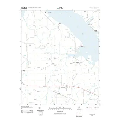
2011 Map of Hillsboro
USGS Topo · Published 2011About this map
Hillsboro serves as the hub of this Lawrence County landscape, where the Hillsboro Post Office and Railroad St reflect the historic connectivity of this northern Alabama town. The terrain is defined by the expansive waters of Wheeler Lake and the Tennessee River to the north, which meet the shore at points like Egypt Bluff and Poplar Point. This area is exceptionally dense with family-named burial sites, providing a significant genealogical resource for the region. Genealogists can find numerous documented locations such as Newman Cemetery, Cottingham Cemetery, Ennix Cemetery, and the Foster-Davis Cemetery. Small settlements like Jerusalem, Lovettville, and Reynolds are interspersed among a network of creeks including Mallard Creek and Dry Creek. The map also captures local landmarks such as Harty Pond and the Swoope Bottom lowlands, illustrating the persistent agricultural and riparian character of the Tennessee Valley.
Find a feature on this map
109 named features on this map. Tap any name to fly to it.
Don’t see what you’re looking for? This feature index may not catch every label — zoom into the map to look around manually.
Map Details
Editions of this 2011 Hillsboro Map
This is the sole edition of this map. No revisions or reprints were ever made.
Other maps of this area

1914 · Rogersville
USGS Topo · 1:48,000

1916 · Rogersville
USGS Topo · 1:62,500

1936 · Caddo
USGS Topo · 1:24,000

1936 · Thorntontown
USGS Topo · 1:24,000

1936 · Stewart Cross Roads
USGS Topo · 1:24,000

1936 · Courtland
USGS Topo · 1:24,000

1936 · Ripley
USGS Topo · 1:24,000

1936 · Trinity
USGS Topo · 1:24,000

1936 · Hillsboro
USGS Topo · 1:24,000

1936 · Cairo
USGS Topo · 1:24,000