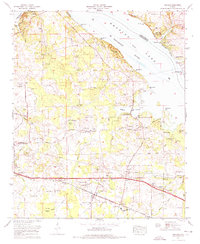
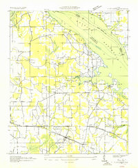
1974 Map of Hillsboro
USGS Topo · Published 1975About this map
The Southern Railway and the Joe Wheeler Highway anchor the southern landscape of this 1974 quadrangle, connecting the town of Hillsboro to the surrounding agricultural and industrial districts. Along the northern edge, the expansive Wheeler Lake section of the Tennessee River defines the geography, marked by prominent riverbank features like Melton Bluff and Egypt Bluff. The introduction of the Browns Ferry Nuclear Plant signifies a major shift in land use near Paradise Shores, contrasting with the numerous small family cemeteries and rural churches that dot the interior. Genealogists will find a dense network of local burial grounds, including the Shackelford Cem, Foster-Davis Cem, and Graves Cem Church, reflecting the area's deep-rooted settlement history. The terrain transitions from the low-lying Baker Bottom and Swoope Bottom near Mallard Creek to the slightly higher elevations of Peters Ridge.
Find a feature on this map
67 named features on this map. Tap any name to fly to it.
Don’t see what you’re looking for? This feature index may not catch every label — zoom into the map to look around manually.
Map Details
Editions of this 1974 Hillsboro Map
This is the sole edition of this map. No revisions or reprints were ever made.
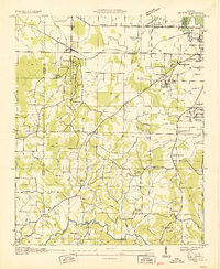
Other maps of this area
1914 · Rogersville
USGS Topo · 1:48,000
1916 · Rogersville
USGS Topo · 1:62,500
1936 · Caddo
USGS Topo · 1:24,000

1936 · Thorntontown
USGS Topo · 1:24,000

1936 · Stewart Cross Roads
USGS Topo · 1:24,000
1936 · Courtland
USGS Topo · 1:24,000

1936 · Ripley
USGS Topo · 1:24,000
1936 · Trinity
USGS Topo · 1:24,000
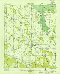
1936 · Hillsboro
USGS Topo · 1:24,000

1936 · Cairo
USGS Topo · 1:24,000