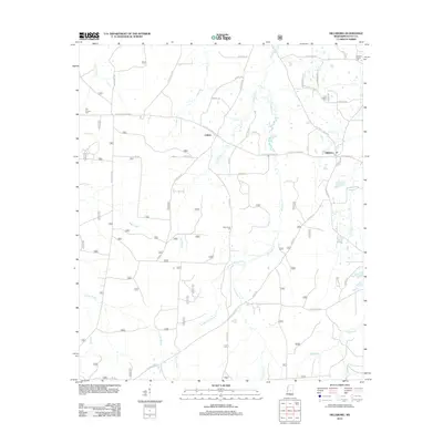
2012 Map of Hillsboro
USGS Topo · Published 2012About this map
Hillsboro and Clifton serve as the primary focal points in this section of Scott County, where the landscape is defined by an intricate network of waterways. The Strong River and Tallabogue dominate the southern drainage, while the northern and central areas are crossed by Shockaloo Cr and its tributary, W Fork Shockaloo Cr. This map documents a rural Mississippi landscape of small settlements and family-named landmarks, such as Old Duncan Cem and Lone Pilgrim Cem, which provide critical reference points for local history and genealogy. The presence of Base Camp Two and various forestry roads like L O Reeves Rd and Tadpole Rd indicates the area's ongoing relationship with the surrounding timberlands. From the Lebanon Church in the northeast to the swampy reaches of Sugar Bogue, the map provides a precise record of the road networks and water features that have shaped the development of this region.
Find a feature on this map
49 named features on this map. Tap any name to fly to it.
Don’t see what you’re looking for? This feature index may not catch every label — zoom into the map to look around manually.
Map Details
Editions of this 2012 Hillsboro Map
This is the sole edition of this map. No revisions or reprints were ever made.
Other maps of this area

1921 · Forest
USGS Topo · 1:48,000

1922 · Forest
USGS Topo · 1:62,500

1922 · Morton
USGS Topo · 1:48,000

1924 · Morton
USGS Topo · 1:62,500

1950 · Forest
USGS Topo · 1:62,500

1951 · Morton
USGS Topo · 1:62,500

1952 · Forest
USGS Topo · 1:62,500

1953 · Meridian
USGS Topo · 1:250,000

1957 · Meridian
USGS Topo · 1:250,000

1961 · Carthage
USGS Topo · 1:62,500