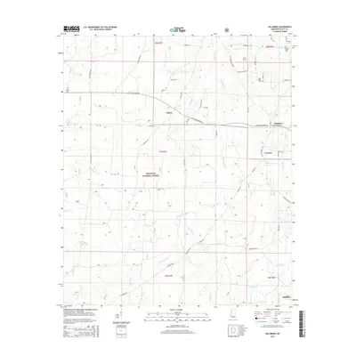
2015 Map of Hillsboro
USGS Topo · Published 2015About this map
Bienville National Forest dominates the central and southern reaches of this landscape in Scott County, where the dense woodland is dissected by an intricate network of waterways. The drainage pattern is particularly complex here, defined by the Shockaloo Cr and its western fork, alongside Sipsey Bogue and the upper reaches of the Strong River. For local historians and genealogists, the map preserves the locations of early rural centers like Hillsboro and Clifton, as well as several small family and community burial sites. Small landmarks like Old Duncan Cem and Lone Pilgrim Cem are shown tucked away from the main thoroughfares. A system of forest roads and historic routes, including Old Hillsboro Rd and Clifton-Hillsboro Rd, connects these scattered settlements across the undulating terrain north of the town of Forest.
Find a feature on this map
52 named features on this map. Tap any name to fly to it.
Don’t see what you’re looking for? This feature index may not catch every label — zoom into the map to look around manually.
Map Details
Editions of this 2015 Hillsboro Map
This is the sole edition of this map. No revisions or reprints were ever made.
Other maps of this area

1921 · Forest
USGS Topo · 1:48,000

1922 · Forest
USGS Topo · 1:62,500

1922 · Morton
USGS Topo · 1:48,000

1924 · Morton
USGS Topo · 1:62,500

1950 · Forest
USGS Topo · 1:62,500

1951 · Morton
USGS Topo · 1:62,500

1952 · Forest
USGS Topo · 1:62,500

1953 · Meridian
USGS Topo · 1:250,000

1957 · Meridian
USGS Topo · 1:250,000

1961 · Carthage
USGS Topo · 1:62,500