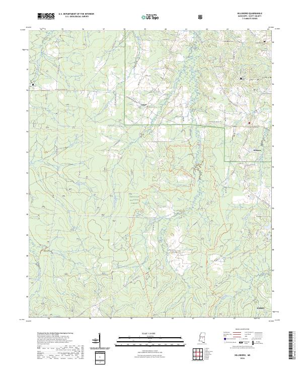
2024 Map of Hillsboro
USGS Topo · Published 2024About this map
Bienville National Forest dominates the southern half of this landscape, where the West Fork Shockaloo Creek and Sugar Bogue define the drainage patterns of central Scott County. The settlement of Hillsboro sits to the east, anchored by its network of local routes like Old Hillsboro Rd and Old Jackson Rd, while the smaller community of Clifton is situated further north along Clifton Hillsboro Rd. Genealogy researchers will find several significant burial sites, including Lone Pilgrim Cem and the Lebanon Church Cem near the northern boundary. The terrain is a complex network of creeks and branches, from Coffee Bogue in the west to the headwaters of the Strong River and Tallabogue in the south, illustrating a rural environment shaped by its waterways and timberlands.
Find a feature on this map
56 named features on this map. Tap any name to fly to it.
Don’t see what you’re looking for? This feature index may not catch every label — zoom into the map to look around manually.
Map Details
Editions of this 2024 Hillsboro Map
This is the sole edition of this map. No revisions or reprints were ever made.
Other maps of this area

1921 · Forest
USGS Topo · 1:48,000

1922 · Forest
USGS Topo · 1:62,500

1922 · Morton
USGS Topo · 1:48,000

1924 · Morton
USGS Topo · 1:62,500

1950 · Forest
USGS Topo · 1:62,500

1951 · Morton
USGS Topo · 1:62,500

1952 · Forest
USGS Topo · 1:62,500

1953 · Meridian
USGS Topo · 1:250,000

1957 · Meridian
USGS Topo · 1:250,000

1961 · Carthage
USGS Topo · 1:62,500