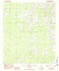
1982 Map of Hillsboro
USGS Topo · Published 1983About this map
Hillsboro and the surrounding timberlands of central Mississippi define this landscape during the early 1980s. Much of the area is dominated by the Bienville National Forest, where a network of forest roads and the Shockaloe Trail weave through the drainage basins of Tallabogue Creek and the Little River. This provisional survey captures a quiet, rural character marked by small communities like Clifton and isolated markers of local history. Genealogy researchers can find several rural houses of worship, including Macedonia Ch and Lone Pilgrim Ch, along with the Old Duncan Cem. The presence of Base Camp 2 within the national forest suggests the area's continued use for resource management and recreation, while the intricate system of branches like Bogue Coffee Branch and Shoesole Creek illustrates the complex hydrology of the Scott County interior.
Find a feature on this map
22 named features on this map. Tap any name to fly to it.
Don’t see what you’re looking for? This feature index may not catch every label — zoom into the map to look around manually.
Map Details
Editions of this 1982 Hillsboro Map
This is the sole edition of this map. No revisions or reprints were ever made.
Other maps of this area

1921 · Forest
USGS Topo · 1:48,000

1922 · Forest
USGS Topo · 1:62,500

1922 · Morton
USGS Topo · 1:48,000

1924 · Morton
USGS Topo · 1:62,500

1950 · Forest
USGS Topo · 1:62,500

1951 · Morton
USGS Topo · 1:62,500

1952 · Forest
USGS Topo · 1:62,500

1953 · Meridian
USGS Topo · 1:250,000

1957 · Meridian
USGS Topo · 1:250,000

1961 · Carthage
USGS Topo · 1:62,500