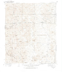
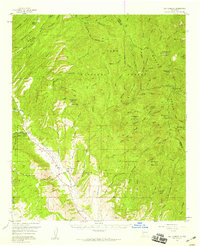
1935 Map of Hillsboro
USGS Topo · Published 1974About this map
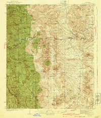
The mining settlements of Hillsboro and Kingston anchor this mid-1930s landscape in Sierra County, New Mexico. Situated along Percha Creek, these towns supported a network of hard-rock operations including the Gray Eagle Mine and Silvertail Mine, alongside prospecting sites like Sawpit. The topographic detail reveals a transitioning economy where ranching began to define the open land between the peaks, evidenced by family-named holdings such as the Mackey Ranch, E Nunn Ranch, and JP Nunn Ranch.
Find a feature on this map
76 named features on this map. Tap any name to fly to it.
Don’t see what you’re looking for? This feature index may not catch every label — zoom into the map to look around manually.
Map Details
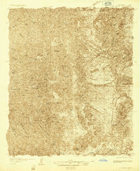
Editions of this 1935 Hillsboro Map
2 editions found
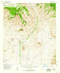
Other maps of this area
1935 · Hillsboro
USGS Topo · 1:48,000
1940 · Hillsboro
USGS Topo · 1:62,500

1954 · Tularosa
USGS Topo · 1:250,000

1955 · Las Cruces
USGS Topo · 1:250,000
1956 · Dwyer
USGS Topo · 1:62,500
1956 · San Lorenzo
USGS Topo · 1:62,500

1958 · Las Cruces
USGS Topo · 1:250,000

1958 · Tularosa
USGS Topo · 1:250,000

1961 · Skute Stone Arroyo
USGS Topo · 1:24,000
1961 · Saladone Tank
USGS Topo · 1:24,000