
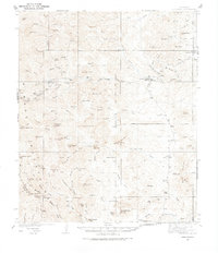
1935 Map of Hillsboro
USGS Topo · Published 1935About this map
Hillsboro and Kingston serve as the primary anchors for this 1935 survey, which details a landscape defined by mining activity and ranching operations during the mid-depression era. The topographic data reveals the industrial footprint of the region through labeled sites like the OK Mine, Gray Eagle Mine, and Silver Tail Mine, while the canyon-riven terrain is dotted with established family holdings including the J P Nunn Ranch, Wilson Ranch, and Mackey Ranch.
Find a feature on this map
82 named features on this map. Tap any name to fly to it.
Don’t see what you’re looking for? This feature index may not catch every label — zoom into the map to look around manually.
Map Details
Editions of this 1935 Hillsboro Map
2 editions found
Other maps of this area

1940 · Hillsboro
USGS Topo · 1:62,500

1954 · Tularosa
USGS Topo · 1:250,000

1955 · Las Cruces
USGS Topo · 1:250,000

1956 · Dwyer
USGS Topo · 1:62,500

1956 · San Lorenzo
USGS Topo · 1:62,500

1958 · Las Cruces
USGS Topo · 1:250,000

1958 · Tularosa
USGS Topo · 1:250,000

1961 · Skute Stone Arroyo
USGS Topo · 1:24,000

1961 · Saladone Tank
USGS Topo · 1:24,000

1961 · Nutt
USGS Topo · 1:62,500