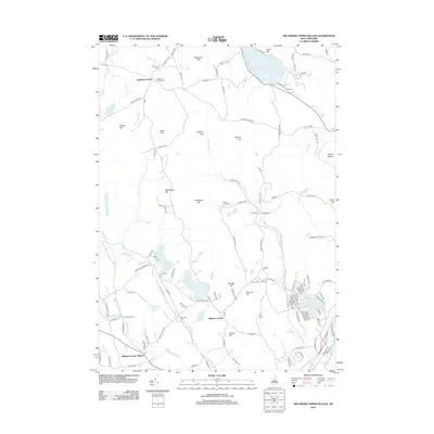
2012 Map of Hillsboro Upper Village
USGS Topo · Published 2012About this map
Bradford Center and Hillsboro Center anchor this landscape of glacial hills and scattered water bodies in the southern New Hampshire highlands. The terrain is defined by a series of prominent rises including Murdough Hill, Thompson Hill, and the ominously named Mount Misery. The hydrography of the region is equally complex, featuring the large Lake Massasecum to the north and the winding Contoocook River in the southeast corner. Numerous smaller ponds like Loon Pond, Gould Pond, and Contention Pond are connected by a network of drainage ways such as Sand Brook and Shedd Brook. Evidence of the area's older transportation infrastructure is visible in the Old Railroad Bd near the river, while the modern settlement pattern concentrates around historic village cores and the shores of Lake Massasecum. This 2012 survey provides a clear view of how these colonial-era centers and 19th-century recreation spots have transitioned into the 21st century.
Find a feature on this map
116 named features on this map. Tap any name to fly to it.
Don’t see what you’re looking for? This feature index may not catch every label — zoom into the map to look around manually.
Map Details
Editions of this 2012 Hillsboro Upper Village Map
This is the sole edition of this map. No revisions or reprints were ever made.
Other maps of this area

1902 · Sunapee
USGS Topo · 1:62,500

1905 · Sunapee
USGS Topo · 1:62,500

1907 · Sunapee
USGS Topo · 1:62,500

1926 · Hillsboro
USGS Topo · 1:62,500

1928 · Mount Kearsarge
USGS Topo · 1:62,500

1929 · Hillsboro
USGS Topo · 1:62,500

1930 · Lovewell Mountain
USGS Topo · 1:62,500

1931 · Mount Kearsarge
USGS Topo · 1:62,500

1942 · Lovewell Mountain
USGS Topo · 1:62,500

1949 · Portland
USGS Topo · 1:250,000