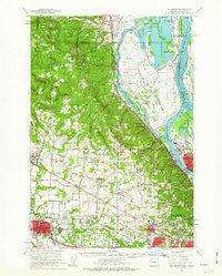
1961 Map of Hillsboro
USGS Topo · Published 1963About this map
Hillsboro serves as a major hub in this early 1960s landscape, where the agricultural Tualatin Valley meets the industrial corridors of the Willamette River. The map captures a complex transport network of the Spokane Portland and Seattle Railway and the Oregon Electric Railway threading through settlements like Orenco and Linnton. To the east, Sauvie Island is defined by a maze of waterways including the Multnomah Channel and Sturgeon Lake, while the western hills rise toward Dixie Mtn. Genealogists will find a wealth of local landmarks, from the Meeks Land Claim Historical Marker near North Plains to numerous country burial grounds such as Tualatin Plains Cem and West Union Cem. The transition from rural homesteads to suburban growth is evident in developments like Marlene Village and Cedar Hills flanking the growing city centers.
Find a feature on this map
176 named features on this map. Tap any name to fly to it.
Don’t see what you’re looking for? This feature index may not catch every label — zoom into the map to look around manually.
Map Details
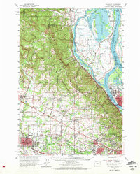
Editions of this 1961 Hillsboro Map
2 editions found
Other maps of this area

1897 · Portland
USGS Topo · 1:62,500

1905 · Portland
USGS Topo · 1:62,500

1914 · Oregon City
USGS Topo · 1:62,500

1915 · Hillsboro
USGS Topo · 1:62,500

1916 · Tualatin
USGS Topo · 1:62,500

1918 · Hillsboro
USGS Topo · 1:62,500

1922 · St. Helens
USGS Topo · 1:62,500

1939 · Oregon City
USGS Topo · 1:62,500

1939 · Tualatin
USGS Topo · 1:62,500

1940 · Tualatin
USGS Topo · 1:62,500