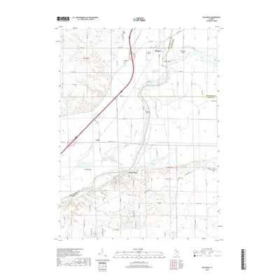
2018 Map of Hillsdale
USGS Topo · Published 2018About this map
The settlement of Hillsdale anchors the northern portion of this map, situated where the terrain transitions toward the intricate waterways of the Rock River basin. This 2018 survey reveals the geographic relationship between small rural communities and the expansive floodplains of Rock Island County. To the southwest, the community of Joslin marks a point of intersection for regional transportation routes, while Shady Beach occupies the northern bank of the river, highlighting the area's development along its primary waterway. The map provides clear visualization of the alluvial landscape, characterized by numerous sloughs and islands that have shaped the agricultural and residential patterns of this Illinois river valley region.
Find a feature on this map
3 named features on this map. Tap any name to fly to it.
Don’t see what you’re looking for? This feature index may not catch every label — zoom into the map to look around manually.
Map Details
Editions of this 2018 Hillsdale Map
This is the sole edition of this map. No revisions or reprints were ever made.
Other maps of this area

1892 · Leclaire
USGS Topo · 1:62,500

1893 · Leclaire
USGS Topo · 1:62,500

1899 · Clinton
USGS Topo · 1:125,000

1934 · Geneseo
USGS Topo · 1:62,500

1937 · Orion
USGS Topo · 1:62,500

1949 · Port Byron
USGS Topo · 1:24,000

1950 · Port Byron
USGS Topo · 1:24,000

1952 · Erie
USGS Topo · 1:62,500
1952 · Cordova
USGS Topo · 1:24,000
1953 · Port Byron
USGS Topo · 1:24,000