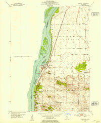
1952 Map of Cordova
USGS Topo · Published 1953About this map
The Mississippi River defines the western edge of this 1952 topographic study, where the Upper Mississippi River Wildlife and Fish Refuge blankets a complex system of islands and inlets. Along the shoreline, the settlements of Cordova and Port Byron serve as anchors for the local community, linked by the tracks of the Chicago Milwaukee St Paul and Pacific railroad. The landscape inland shifts toward agricultural and rural use, punctuated by local landmarks that reflect mid-century civic life.
Find a feature on this map
16 named features on this map. Tap any name to fly to it.
Don’t see what you’re looking for? This feature index may not catch every label — zoom into the map to look around manually.
Map Details
Editions of this 1952 Cordova Map
This is the sole edition of this map. No revisions or reprints were ever made.
Other maps of this area

1891 · Clinton
USGS Topo · 1:62,500

1892 · Goose Lake
USGS Topo · 1:62,500

1892 · Leclaire
USGS Topo · 1:62,500

1893 · Leclaire
USGS Topo · 1:62,500

1894 · Goose Lake
USGS Topo · 1:62,500

1894 · Clinton
USGS Topo · 1:62,500

1899 · Clinton
USGS Topo · 1:125,000

1949 · Silvis
USGS Topo · 1:24,000

1949 · Port Byron
USGS Topo · 1:24,000

1950 · Port Byron
USGS Topo · 1:24,000