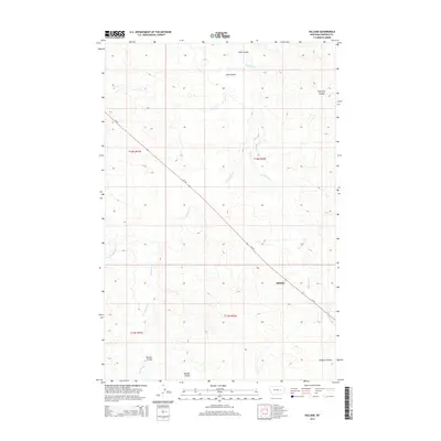
2014 Map of Hillside
USGS Topo · Published 2014About this map
Hillside sits at the intersection of high prairie drainage and modern transit in this rural section of Garfield County. The landscape is defined by an intricate network of coulees and creeks that carve through the terrain, notably Thompson Cr and its northern tributaries like Todd Coulee and Artz Coulee. These features represent the classic watershed topography of eastern Montana, where seasonal runoff has sculpted the earth over generations. To the southeast, Red Butte Cr and Douglas Coulee further illustrate this drainage pattern, while MT-59 provides the primary north-south artery through the township boundaries of T14N R41E and T13N R42E. The map captures the quiet character of the region, where named landmarks often reflect early ranching families and the geographic necessity of locating water in a semi-arid environment.
Find a feature on this map
14 named features on this map. Tap any name to fly to it.
Don’t see what you’re looking for? This feature index may not catch every label — zoom into the map to look around manually.
Map Details
Editions of this 2014 Hillside Map
This is the sole edition of this map. No revisions or reprints were ever made.
Other maps of this area

1954 · Jordan
USGS Topo · 1:250,000

1954 · Forsyth
USGS Topo · 1:250,000

1956 · Jordan
USGS Topo · 1:250,000

1957 · Forsyth
USGS Topo · 1:250,000

1958 · Jordan
USGS Topo · 1:250,000

1958 · Forsyth
USGS Topo · 1:250,000

1964 · Jordan
USGS Topo · 1:250,000

1965 · Needle Butte
USGS Topo · 1:24,000

1965 · Cohagen
USGS Topo · 1:24,000

1965 · Clear Water Reservoir
USGS Topo · 1:24,000