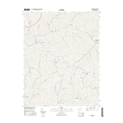
2016 Map of Hindman
USGS Topo · Published 2016About this map
Hindman serves as a focal point in this portion of Knott County, situated at the confluence of Troublesome Cr and its various branches. The landscape is defined by a dense network of hollows and ridges, with settlements like Pippa Passes and Brinkley tucked into the narrow valleys. The presence of Alice Lloyd Coll in the eastern section highlights the area's educational roots, while smaller communities such as Garner, Leburn, and Pine Top are connected by winding roads that follow the natural contours of the land. Genealogists and local historians can find family-named landmarks and historical sites like the Madden Cem near Amburgey. The intricate hydrography, including Irishman Creek and Carr Fork, illustrates the historical reliance on these waterways for both transport and settlement patterns in the Kentucky hills during the early 21st century.
Find a feature on this map
101 named features on this map. Tap any name to fly to it.
Don’t see what you’re looking for? This feature index may not catch every label — zoom into the map to look around manually.
Map Details
Editions of this 2016 Hindman Map
This is the sole edition of this map. No revisions or reprints were ever made.
Other maps of this area

1890 · Whitesburg
USGS Topo · 1:125,000

1891 · Hazard
USGS Topo · 1:125,000

1892 · Whitesburg
USGS Topo · 1:125,000

1912 · Hindman
USGS Topo · 1:48,000

1913 · Oven Fork
USGS Topo · 1:48,000

1914 · Troublesome
USGS Topo · 1:62,500

1915 · Hindman
USGS Topo · 1:62,500

1915 · Whitesburg
USGS Topo · 1:62,500

1916 · Cornettsville
USGS Topo · 1:62,500
1954 · Hindman
USGS Topo · 1:24,000