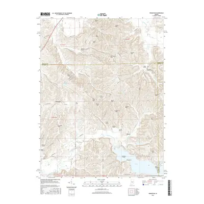
2016 Map of Hindustan
USGS Topo · Published 2016About this map
Lake Lemon dominates the southern landscape of this 2016 survey, a significant reservoir area featuring Riddle Point and the curious Cemetery Island. The terrain is characterized by a dense network of ridges and hollows, including Pea Ridge, Cracky Ridge, and Deadman Hollow. Small settlements and historic junctions like Hindustan and Fleener are situated along a complex web of rural roads such as E Chambers Pike and Old State Rd 37 S. For genealogists, the map identifies several local burial sites including Shiloh Cem, Stepp Cem, and Taylor Cem, often located on high ground above the many winding waterways like Beanblossom Creek and Little Indian Cr. The drainage patterns, from Greasley Cr to Honey Cr, illustrate the complex topography where the borders of Monroe, Morgan, and Brown Counties meet.
Find a feature on this map
114 named features on this map. Tap any name to fly to it.
Don’t see what you’re looking for? This feature index may not catch every label — zoom into the map to look around manually.
Map Details
Editions of this 2016 Hindustan Map
This is the sole edition of this map. No revisions or reprints were ever made.
Other maps of this area

1908 · Bloomington
USGS Topo · 1:48,000

1910 · Bloomington
USGS Topo · 1:62,500

1942 · Franklin
USGS Topo · 1:125,000

1946 · Belmont
USGS Topo · 1:24,000

1947 · Unionville
USGS Topo · 1:24,000

1948 · Hindustan
USGS Topo · 1:24,000

1948 · Morgantown
USGS Topo · 1:24,000

1950 · Belmont
USGS Topo · 1:24,000

1950 · Morgantown
USGS Topo · 1:24,000

1953 · Indianapolis
USGS Topo · 1:250,000