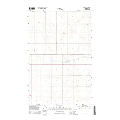
2014 Map of Hingham
USGS Topo · Published 2014About this map
Hingham serves as the central hub of this northern Montana landscape, situated along the southern edge of a vast agricultural expanse. The town's grid is concentrated near Us-2, featuring localized landmarks such as the Po and streets like Elstone Ave and 3rd St S. The surrounding terrain is defined by its section-line road network and natural drainages, most notably the meandering path of England Coulee which cuts across the central townships. To the north, Pester Airport marks a remote point of aviation infrastructure amidst the prairie. This 2014 survey documents a classic High Line community, where the orientation of the land remains deeply tied to the township and range system, seen through boundaries like t33n r10e and the numerous rural routes including Hingham Rd and Road 30 N.
Find a feature on this map
30 named features on this map. Tap any name to fly to it.
Don’t see what you’re looking for? This feature index may not catch every label — zoom into the map to look around manually.
Map Details
Editions of this 2014 Hingham Map
This is the sole edition of this map. No revisions or reprints were ever made.
Other maps of this area

1919 · Big Sandy
USGS Topo · 1:125,000

1919 · Alma
USGS Topo · 1:125,000

1920 · Gildford
USGS Topo · 1:125,000

1943 · Gildford
USGS Topo · 1:125,000

1954 · Shelby
USGS Topo · 1:250,000

1958 · Shelby
USGS Topo · 1:250,000

1969 · Gildford NE
USGS Topo · 1:24,000

1969 · Gildford NW
USGS Topo · 1:24,000

1969 · Hingham
USGS Topo · 1:24,000

1969 · Fourteenmile Coulee NW
USGS Topo · 1:24,000