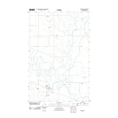
2011 Map of Hinsdale
USGS Topo · Published 2011About this map
Hinsdale serves as the central hub of this Valley County landscape, where the winding course of the Milk River meets the drainages of Beaver Creek and Rock Creek. The geography is defined by a series of coulees, including Limekiln Coulee and Tank Coulee, which cut through the northern plains to meet the fertile river valley. This 2011 survey highlights the enduring cattle and ranching heritage of the region, identifying established properties such as Roub's Ranch, Whitmore's Ranch, and Wooldridge's Ranch scattered across the northern reaches and eastern irrigation canals. Infrastructure near the town center includes the Hinsdale Airport, the Hinsdale Post Office, and Hillview Cemetery, providing a detailed look at the civic layout of this rural community. The complex hydrology of the area is further evidenced by Baalke Slough and the Rock Creek Canal, indicating the intensive water management required for agriculture in this part of Montana.
Find a feature on this map
38 named features on this map. Tap any name to fly to it.
Don’t see what you’re looking for? This feature index may not catch every label — zoom into the map to look around manually.
Map Details
Editions of this 2011 Hinsdale Map
This is the sole edition of this map. No revisions or reprints were ever made.
Other maps of this area

1906 · Hinsdale Special Map
USGS Topo · 1:62,500

1919 · Boundary
USGS Topo · 1:125,000

1943 · Glasgow
USGS Topo · 1:125,000

1954 · Glasgow
USGS Topo · 1:250,000

1957 · Glasgow
USGS Topo · 1:250,000

1958 · Glasgow
USGS Topo · 1:250,000

1969 · Vandalia
USGS Topo · 1:24,000

1969 · Ellsworth Coulee
USGS Topo · 1:24,000

1984 · Bjornberg Bridge
USGS Topo · 1:24,000

1984 · Opheim
USGS Topo · 1:100,000