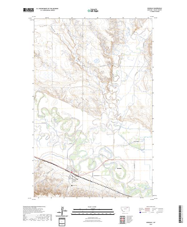
2024 Map of Hinsdale
USGS Topo · Published 2024About this map
Hinsdale serves as a central hub in this northern Montana landscape, situated where the Milk River meanders through a broad valley floor defined by complex oxbows and irrigation infrastructure. The town's layout is closely tied to the Lewis And Clark Trl and a network of local thoroughfares like 1st Ave N and 3rd Ave N. This area highlights the transition from the river's riparian zone to the higher surrounding plains, marked by numerous drainage features such as Turnip Coulee and Limekiln Coulee.
Find a feature on this map
36 named features on this map. Tap any name to fly to it.
Don’t see what you’re looking for? This feature index may not catch every label — zoom into the map to look around manually.
Map Details
Editions of this 2024 Hinsdale Map
This is the sole edition of this map. No revisions or reprints were ever made.
Other maps of this area

1906 · Hinsdale Special Map
USGS Topo · 1:62,500

1919 · Boundary
USGS Topo · 1:125,000

1943 · Glasgow
USGS Topo · 1:125,000

1954 · Glasgow
USGS Topo · 1:250,000

1957 · Glasgow
USGS Topo · 1:250,000

1958 · Glasgow
USGS Topo · 1:250,000

1969 · Vandalia
USGS Topo · 1:24,000

1969 · Ellsworth Coulee
USGS Topo · 1:24,000

1984 · Bjornberg Bridge
USGS Topo · 1:24,000

1984 · Opheim
USGS Topo · 1:100,000