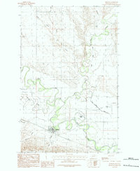
1984 Map of Hinsdale
USGS Topo · Published 1984About this map
Hinsdale serves as the focal point of this 1980s-era topographic study, situated at the confluence of several significant waterways in Valley County. The landscape is defined by the winding course of the Milk River and its meeting with Beaver Creek and Rock Creek. This intricate drainage system creates a complex network of coulees and sloughs, including the distinctive Baalke Slough and Limekiln Coulee.
Find a feature on this map
15 named features on this map. Tap any name to fly to it.
Don’t see what you’re looking for? This feature index may not catch every label — zoom into the map to look around manually.
Map Details
Editions of this 1984 Hinsdale Map
This is the sole edition of this map. No revisions or reprints were ever made.
Other maps of this area

1906 · Hinsdale Special Map
USGS Topo · 1:62,500

1919 · Boundary
USGS Topo · 1:125,000

1943 · Glasgow
USGS Topo · 1:125,000

1954 · Glasgow
USGS Topo · 1:250,000

1957 · Glasgow
USGS Topo · 1:250,000

1958 · Glasgow
USGS Topo · 1:250,000

1969 · Vandalia
USGS Topo · 1:24,000

1969 · Ellsworth Coulee
USGS Topo · 1:24,000

1984 · Bjornberg Bridge
USGS Topo · 1:24,000

1984 · Opheim
USGS Topo · 1:100,000