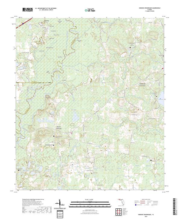
2024 Map of Hinsons Crossroads
USGS Topo · Published 2024About this map
Choctawhatchee River defines the central geography of this Florida landscape, winding through a complex network of wetlands and named clearings. The river's influence is evident in features like Hog Island, Sawed Slough, and Yates Swamp, illustrating the intricate hydrologic patterns of the Panhandle. Small agricultural and residential nodes are scattered across the terrain, notably at Hinsons Crossroads and Whitehead Crossroads.
Find a feature on this map
134 named features on this map. Tap any name to fly to it.
Don’t see what you’re looking for? This feature index may not catch every label — zoom into the map to look around manually.
Map Details
Editions of this 2024 Hinsons Crossroads Map
This is the sole edition of this map. No revisions or reprints were ever made.
Other maps of this area

1948 · Ponce De Leon
USGS Topo · 1:24,000

1949 · Millers Ferry
USGS Topo · 1:24,000

1949 · Redbay
USGS Topo · 1:24,000

1949 · Hinsons Cross Roads
USGS Topo · 1:24,000

1949 · Caryville
USGS Topo · 1:24,000

1950 · Prosperity
USGS Topo · 1:24,000

1950 · Millers Ferry
USGS Topo · 1:24,000

1950 · Ponce De Leon
USGS Topo · 1:24,000

1950 · Hinsons Cross Roads
USGS Topo · 1:24,000

1950 · Redbay
USGS Topo · 1:24,000