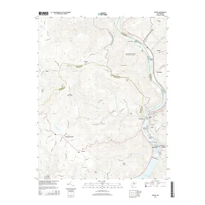
2014 Map of Hinton
USGS Topo · Published 2014About this map
The confluence of the New River and the Greenbrier River defines the landscape of this 2014 survey, where the city of Hinton serves as a central hub. The river system is a dominant feature, carving through the terrain and creating notable landforms like Coney Island and Bushes Island near the town of Avis. To the south, the waters of Bluestone Lake represent a major geographic boundary, while the northern reaches of the map include protected lands within the New River Gorge National River. Smaller settlements such as Nimitz, Jumping Branch, and Brooks are connected by a network of local roads like Pluto Rd and Freezeland Rd. Genealogists will find several burial sites noted across the ridges, including Crews Cem, Restwood Cem, and Hilltop Cem, offering a detailed look at the rural cemetery placement in Summers County.
Find a feature on this map
111 named features on this map. Tap any name to fly to it.
Don’t see what you’re looking for? This feature index may not catch every label — zoom into the map to look around manually.
Map Details
Editions of this 2014 Hinton Map
This is the sole edition of this map. No revisions or reprints were ever made.
Other maps of this area

1887 · Hinton
USGS Topo · 1:125,000

1891 · Raleigh
USGS Topo · 1:125,000

1892 · Hinton
USGS Topo · 1:125,000

1897 · Raleigh
USGS Topo · 1:125,000

1902 · Raleigh
USGS Topo · 1:125,000

1911 · Flattop
USGS Topo · 1:48,000

1911 · Beckley
USGS Topo · 1:48,000

1912 · Meadow Creek
USGS Topo · 1:48,000

1912 · Big Bend
USGS Topo · 1:62,500

1913 · Beckley
USGS Topo · 1:62,500