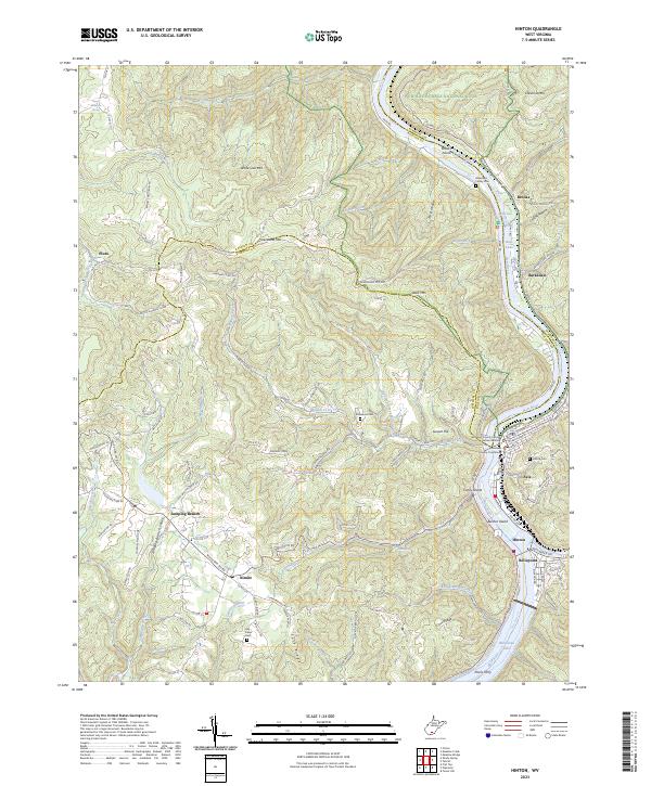
2023 Map of Hinton
USGS Topo · Published 2023About this map
The confluence of the New River and Greenbrier River anchors this study of the terrain where Summers and Raleigh counties meet. At the heart of the landscape, Hinton and Avis serve as the primary hubs, with the Summers County Courthouse and Summers County Judicial Annex Building marking the civic center. The river system dominates the eastern edge, flowing past Brooks Island, Coney Island, and Bushes Island before reaching the wide expanse of Bluestone Lake near Packs Ferry.
Find a feature on this map
123 named features on this map. Tap any name to fly to it.
Don’t see what you’re looking for? This feature index may not catch every label — zoom into the map to look around manually.
Map Details
Editions of this 2023 Hinton Map
This is the sole edition of this map. No revisions or reprints were ever made.
Other maps of this area

1887 · Hinton
USGS Topo · 1:125,000

1891 · Raleigh
USGS Topo · 1:125,000

1892 · Hinton
USGS Topo · 1:125,000

1897 · Raleigh
USGS Topo · 1:125,000

1902 · Raleigh
USGS Topo · 1:125,000

1911 · Flattop
USGS Topo · 1:48,000

1911 · Beckley
USGS Topo · 1:48,000

1912 · Meadow Creek
USGS Topo · 1:48,000

1912 · Big Bend
USGS Topo · 1:62,500

1913 · Beckley
USGS Topo · 1:62,500