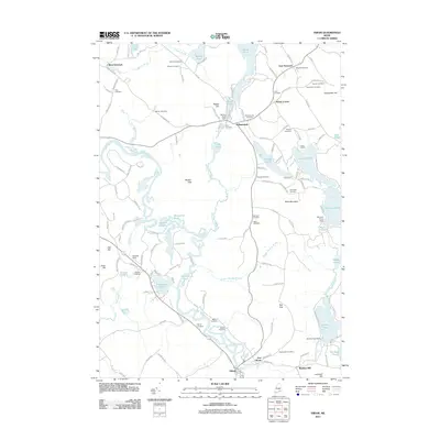
2011 Map of Hiram
USGS Topo · Published 2011About this map
The Saco River winds through this Maine landscape, creating a complex corridor of wetlands and backwaters including Boston Pond, Horseshoe Pond, and Pequawket Pond. The settlement pattern centers on the village of Denmark, situated at the southern end of Moose Pond, and the town of Hiram to the south. Numerous smaller communities like East Denmark, West Denmark, and Heads Corner are connected by a network of rural roads that skirt the base of prominent rises such as Pickett Hill and Allen Mountain.
Find a feature on this map
142 named features on this map. Tap any name to fly to it.
Don’t see what you’re looking for? This feature index may not catch every label — zoom into the map to look around manually.
Map Details
Editions of this 2011 Hiram Map
This is the sole edition of this map. No revisions or reprints were ever made.
Other maps of this area

1896 · Norway
USGS Topo · 1:62,500

1896 · Sebago
USGS Topo · 1:62,500

1909 · Fryeburg
USGS Topo · 1:62,500

1910 · Kezar Falls
USGS Topo · 1:48,000

1911 · Fryeburg
USGS Topo · 1:62,500

1911 · Kezar Falls
USGS Topo · 1:62,500

1941 · Fryeburg
USGS Topo · 1:62,500

1942 · Sebago Lake
USGS Topo · 1:62,500

1943 · Sebago Lake
USGS Topo · 1:62,500

1946 · Norway
USGS Topo · 1:62,500