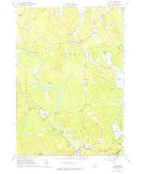
1964 Map of Hiram
USGS Topo · Published 1966About this map
Maine Central Railroad tracks follow the winding course of the Saco River through this mid-1960s landscape, connecting the villages of Hiram and East Hiram. The area is characterized by a high density of small family cemeteries, such as the Fessenden Cem, Harnden Cem, and Berry Cem, which offer significant genealogical value for researchers tracing local lineages. The terrain is defined by prominent peaks like Allen Mountain and Fessenden Hill interspersed with numerous water bodies, including the large Moose Pond and the smaller Pequawket Pond. Near the town of Denmark, the presence of Camp Walden and a Girls Camp indicates the area's established role in seasonal recreation. Downstream at the edge of the Baldwin town line, Rankins Mill stands near the confluence of local brooks and the river, reflecting the region's historic milling and transport nexus.
Find a feature on this map
72 named features on this map. Tap any name to fly to it.
Don’t see what you’re looking for? This feature index may not catch every label — zoom into the map to look around manually.
Map Details
Editions of this 1964 Hiram Map
2 editions found
Other maps of this area

1896 · Norway
USGS Topo · 1:62,500

1896 · Sebago
USGS Topo · 1:62,500

1909 · Fryeburg
USGS Topo · 1:62,500

1910 · Kezar Falls
USGS Topo · 1:48,000

1911 · Fryeburg
USGS Topo · 1:62,500

1911 · Kezar Falls
USGS Topo · 1:62,500

1941 · Fryeburg
USGS Topo · 1:62,500

1942 · Sebago Lake
USGS Topo · 1:62,500

1943 · Sebago Lake
USGS Topo · 1:62,500

1946 · Norway
USGS Topo · 1:62,500