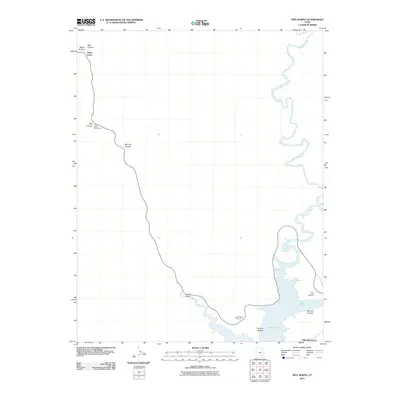
2011 Map of Hite North
USGS Topo · Published 2011About this map
Lake Powell dominates the lower portion of this landscape where the waters submerge the canyon floor. The drainage of the Dirty Devil River snakes from the north to join the reservoir near the former location of Hite (Historical). This 2011 survey documents a transition in the Utah desert, where modern infrastructure like the Hite Airport and Route 95 interact with deep-cut natural features including Marinus Canyon and Butler Canyon. Public access points like the Lake Powell Overlook and Hog Spring Picnic Area indicate the area's role as a recreation gateway. The map also records the location of Three Forks at the head of Stair Canyon, providing a detailed look at the hydrology and terrain before the river enters the inundated depths of Narrow Canyon.
Find a feature on this map
15 named features on this map. Tap any name to fly to it.
Don’t see what you’re looking for? This feature index may not catch every label — zoom into the map to look around manually.
Map Details
Editions of this 2011 Hite North Map
This is the sole edition of this map. No revisions or reprints were ever made.
Other maps of this area

1885 · San Rafael
USGS Topo · 1:250,000

1886 · Henry Mountains
USGS Topo · 1:250,000

1892 · Henry Mountains
USGS Topo · 1:250,000

1952 · Orange Cliffs 3 SW
USGS Topo · 1:24,000

1952 · Mt Pennell 1 NE
USGS Topo · 1:24,000

1952 · Mt Hillers
USGS Topo · 1:62,500

1952 · Mt Pennell 1 SE
USGS Topo · 1:24,000

1952 · Hite
USGS Topo · 1:62,500

1952 · Bull Mountain
USGS Topo · 1:62,500

1953 · Orange Cliffs 3 SE
USGS Topo · 1:24,000