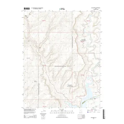
2014 Map of Hite North
USGS Topo · Published 2014About this map
Glen Canyon National Recreation Area dominates this desert landscape at the confluence of several major canyon systems. The Dirty Devil River winds through the northeast, eventually meeting the expansive waters of Lake Powell in the south near Narrow Canyon. This modern survey illustrates the specialized infrastructure of the region, including the Hite Marina and the remote Hite Airport, which serve visitors to the river and lake. Steep elevation changes are marked by distinct landforms such as Trachyte Point and deeply carved drainages like Big Horn Sheep Canyon, Stair Canyon, and Butler Canyon. Remote transport is facilitated by Ut-95, which snakes across the terrain, and the primitive Flint Trl, providing access to the high desert plateaus above the water.
Find a feature on this map
22 named features on this map. Tap any name to fly to it.
Don’t see what you’re looking for? This feature index may not catch every label — zoom into the map to look around manually.
Map Details
Editions of this 2014 Hite North Map
This is the sole edition of this map. No revisions or reprints were ever made.
Other maps of this area

1885 · San Rafael
USGS Topo · 1:250,000

1886 · Henry Mountains
USGS Topo · 1:250,000

1892 · Henry Mountains
USGS Topo · 1:250,000

1952 · Orange Cliffs 3 SW
USGS Topo · 1:24,000

1952 · Mt Pennell 1 NE
USGS Topo · 1:24,000

1952 · Mt Hillers
USGS Topo · 1:62,500

1952 · Mt Pennell 1 SE
USGS Topo · 1:24,000

1952 · Hite
USGS Topo · 1:62,500

1952 · Bull Mountain
USGS Topo · 1:62,500

1953 · Orange Cliffs 3 SE
USGS Topo · 1:24,000