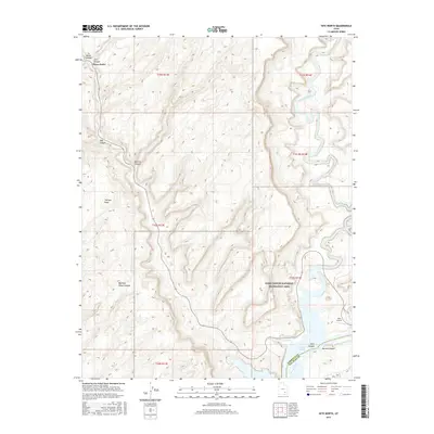
2017 Map of Hite North
USGS Topo · Published 2017About this map
Glen Canyon National Recreation Area dominates this landscape, where the confluence of the Dirty Devil River and the Colorado River defines the geography of northern San Juan County. The 2017 survey reveals the intricate canyons and high points that characterize this desert region, including Trachyte Point and Glencove. The presence of the Hite Airport and the settlement of Hite at the edge of Narrow Canyon indicates the area's importance as a gateway for river and reservoir access. Historical paths like the Flint Trail wind through the topography, connecting the high plateaus to the water's edge at Lake Powell. Numerous secondary drainages such as Big Horn Sheep Canyon, Marinus Canyon, and Hog Canyon carve through the earth, illustrating the erosion patterns typical of the Glen Canyon system before it meets the rising waters of the reservoir.
Find a feature on this map
24 named features on this map. Tap any name to fly to it.
Don’t see what you’re looking for? This feature index may not catch every label — zoom into the map to look around manually.
Map Details
Editions of this 2017 Hite North Map
This is the sole edition of this map. No revisions or reprints were ever made.
Other maps of this area

1885 · San Rafael
USGS Topo · 1:250,000

1886 · Henry Mountains
USGS Topo · 1:250,000

1892 · Henry Mountains
USGS Topo · 1:250,000

1952 · Orange Cliffs 3 SW
USGS Topo · 1:24,000

1952 · Mt Pennell 1 NE
USGS Topo · 1:24,000

1952 · Mt Hillers
USGS Topo · 1:62,500

1952 · Mt Pennell 1 SE
USGS Topo · 1:24,000

1952 · Hite
USGS Topo · 1:62,500

1952 · Bull Mountain
USGS Topo · 1:62,500

1953 · Orange Cliffs 3 SE
USGS Topo · 1:24,000