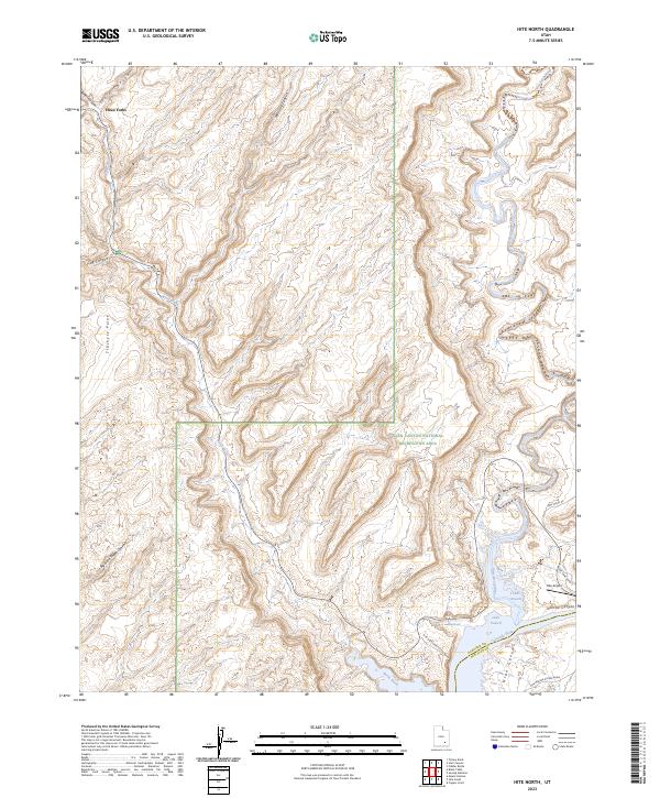
2023 Map of Hite North
USGS Topo · Published 2023About this map
The Colorado River and the Dirty Devil River converge in this high-desert landscape, feeding into the northern reaches of Lake Powell. This recent survey illustrates the modern topography of the Glen Canyon National Recreation Area on the border of Garfield and San Juan Counties. The intricate drainage systems of Butler Canyon and Stair Canyon flow into the North Wash, while the Big Horn Sheep Canyon defines the southwestern terrain. Local transportation and recreation infrastructure are concentrated near the water, including the Hite Airport, Glencove, and the Hite Marina Access Road. This data reflects the contemporary water levels and access points for the river-delta environment where silt and canyon geology meet the reservoir, providing a clear record of the area's current geography and landmark names like Three Forks and Trachyte Point.
Find a feature on this map
22 named features on this map. Tap any name to fly to it.
Don’t see what you’re looking for? This feature index may not catch every label — zoom into the map to look around manually.
Map Details
Editions of this 2023 Hite North Map
This is the sole edition of this map. No revisions or reprints were ever made.
Other maps of this area

1885 · San Rafael
USGS Topo · 1:250,000

1886 · Henry Mountains
USGS Topo · 1:250,000

1892 · Henry Mountains
USGS Topo · 1:250,000

1952 · Orange Cliffs 3 SW
USGS Topo · 1:24,000

1952 · Mt Pennell 1 NE
USGS Topo · 1:24,000

1952 · Mt Hillers
USGS Topo · 1:62,500

1952 · Mt Pennell 1 SE
USGS Topo · 1:24,000

1952 · Hite
USGS Topo · 1:62,500

1952 · Bull Mountain
USGS Topo · 1:62,500

1953 · Orange Cliffs 3 SE
USGS Topo · 1:24,000