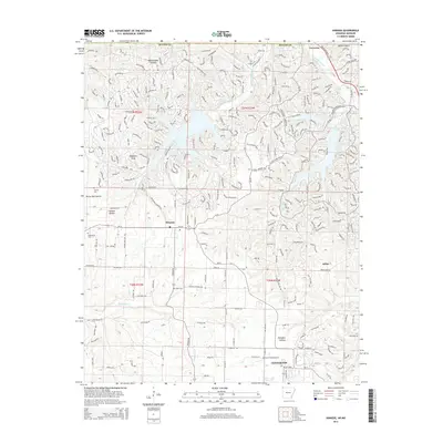
2014 Map of Hiwasse
USGS Topo · Published 2014About this map
Hiwasse and the northern outskirts of Centerton characterize this landscape in the western reaches of Benton County. The area is defined by its transition from the rolling terrain of Gobblers Knob and the winding hollows like Rattlesnake Hollow to the expanding residential developments in the south. This 2014 survey documents the dense network of roads such as Branchwood Dr and Glasgow Rd that surround the waters of Lake Windsor and Lake Avalon. Local heritage is anchored by several rural burying grounds, including Miller Cem, Keith Cem, and Mt Pleasant Cem, which remain as fixed points amidst the 21st-century suburban growth. To the south, Ashmore Field Airport sits near the developing edge of the county seat, while the northern border with Missouri is marked by the small settlement of Caverena near the headwaters of Little Sugar Creek.
Find a feature on this map
264 named features on this map. Tap any name to fly to it.
Don’t see what you’re looking for? This feature index may not catch every label — zoom into the map to look around manually.
Map Details
Editions of this 2014 Hiwasse Map
This is the sole edition of this map. No revisions or reprints were ever made.
Other maps of this area

1899 · Fayetteville
USGS Topo · 1:125,000

1901 · Fayetteville
USGS Topo · 1:125,000

1904 · Fayetteville
USGS Topo · 1:125,000

1940 · Noel
USGS Topo · 1:62,500

1941 · Rocky Comfort
USGS Topo · 1:62,500

1943 · Noel
USGS Topo · 1:62,500

1943 · Rocky Comfort
USGS Topo · 1:62,500

1954 · Tulsa
USGS Topo · 1:250,000

1958 · Tulsa
USGS Topo · 1:250,000

1963 · Tulsa
USGS Topo · 1:250,000