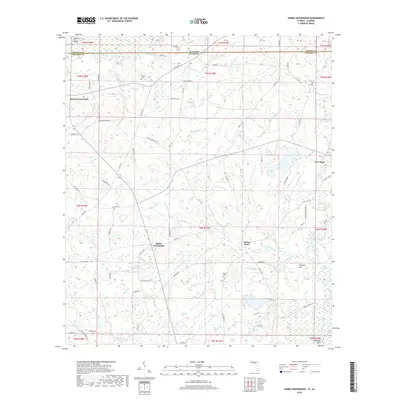
2018 Map of Hobbs Crossroads
USGS Topo · Published 2018About this map
The Alabama-Florida state line bisects this landscape, separating Geneva County from Holmes County. The Pea River flows through the northwest corner, crossed by the Stephens Ferry Bridge, a site echoing the area's river-crossing history. Small rural communities like Hobbs Crossroads and Royals Crossroads are connected by a network of dirt and paved roads, including County Road 185 and Morrison Road. This region is characterized by a high concentration of wetland features and named bays, such as Eldridge Bay, Jameson Bay, and Turkeypen Bay. For genealogists and local historians, several family-named landmarks are visible, including the Merrill Cemetery, Royals Cemetery, and McDuffie Cemetery, which serve as quiet markers of the families who settled this timber and farm country. The topography is dotted with numerous small ponds and lakes like Rock Pond and Little Gar Lake, alongside descriptive watercourses such as Crooked Run and the curiously named Thundering Spring.
Find a feature on this map
104 named features on this map. Tap any name to fly to it.
Don’t see what you’re looking for? This feature index may not catch every label — zoom into the map to look around manually.
Map Details
Editions of this 2018 Hobbs Crossroads Map
This is the sole edition of this map. No revisions or reprints were ever made.
Other maps of this area

1942 · Enterprise
USGS Topo · 1:125,000

1949 · Glendale
USGS Topo · 1:62,500

1949 · Hobbs Crossroads
USGS Topo · 1:24,000

1949 · Caryville
USGS Topo · 1:24,000

1950 · Hobbs Cross Roads
USGS Topo · 1:24,000

1950 · Prosperity
USGS Topo · 1:24,000

1950 · Caryville
USGS Topo · 1:24,000

1950 · Izagora
USGS Topo · 1:24,000

1951 · Glendale
USGS Topo · 1:62,500

1953 · Andalusia
USGS Topo · 1:250,000