Loading...
Loading map...1954 Map of Hobbs
USGS Topo · Published 1974About this map
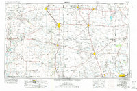
The High Plains and Permian Basin transition is captured here in 1954, as the oil industry reshaped the landscape of the Texas-New Mexico border. Industrial hubs like Hobbs and Lovington anchor a vast network of oil fields, pipelines, and pump stations that stretch across the Querecho Plains and into the Mescalero Sands. Small company towns and ranching outposts such as Humble City, Monument, and Frankel City are plotted amidst a terrain marked by numerous sinkholes and dry washes like Monument Draw.
Find a feature on this map
88 named features on this map. Tap any name to fly to it.
Don’t see what you’re looking for? This feature index may not catch every label — zoom into the map to look around manually.
Map Details
Date Portrayed1954
Date Published1974
PublisherU.S. Geological Survey
Map TypeTopographic
Scale1:250,000
Physical Dimensions33.4 x 22.2 inches
Editions of this 1954 Hobbs Map
2 editions found

Historical Maps of Midland Through Time
2 maps found

Featured Locations
Source Details
SourceU.S. Geological Survey
CopyrightPublic Domain