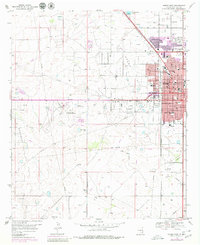
1969 Map of Hobbs West
USGS Topo · Published 1980About this map
The oil-rich landscape of Lea County unfolds across this survey, centered on the western expansion of Hobbs during a period of significant mid-century growth. The map illustrates a transition from the structured street grid of the city, featuring numerous educational and religious institutions like Sanger Sch and Aldersgate Ch, to the industrial and natural features of the High Plains. To the west, the arid expanse of the Monument Alkali Flat contrasts with the intensive energy infrastructure of the Permian Basin, marked by a dense network of pipelines and a large Refinery. Aviation and leisure sites are prominent, including the Lea County-Hobbs Airport and the nearby Hobbs Country Club, while the small settlement of Nadine sits at the southern edge of the sheet along the Texas-New Mexico rail line.
Find a feature on this map
46 named features on this map. Tap any name to fly to it.
Don’t see what you’re looking for? This feature index may not catch every label — zoom into the map to look around manually.
Map Details
Editions of this 1969 Hobbs West Map
2 editions found
Other maps of this area

1954 · Hobbs
USGS Topo · 1:250,000

1958 · Hobbs
USGS Topo · 1:250,000

1962 · Lovington
USGS Topo · 1:62,500

1963 · Monument
USGS Topo · 1:62,500

1969 · Humble City
USGS Topo · 1:24,000

1969 · Hobbs SW
USGS Topo · 1:24,000

1969 · Hobbs East
USGS Topo · 1:24,000

1969 · Hobbs SE
USGS Topo · 1:24,000

1969 · Hobbs West
USGS Topo · 1:24,000

1969 · Humble City SE
USGS Topo · 1:24,000