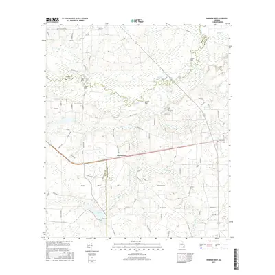
2017 Map of Hoboken West
USGS Topo · Published 2017About this map
The Satilla River carves a winding path across this landscape in Brantley County, defining a complex system of reaches and river bluffs including Blue Hole Reach, Dark Hole Reach, and Yellow Bluff. The terrain is characterized by expansive wetlands such as Raulerson Swamp and numerous drainage creeks like Big Creek and Mill Cr. This 2017 survey details the rural character of the region, where small settlements and family burial grounds are dispersed among the woodlands and water bodies.
Find a feature on this map
116 named features on this map. Tap any name to fly to it.
Don’t see what you’re looking for? This feature index may not catch every label — zoom into the map to look around manually.
Map Details
Editions of this 2017 Hoboken West Map
This is the sole edition of this map. No revisions or reprints were ever made.
Other maps of this area

1953 · Waycross
USGS Topo · 1:250,000

1958 · Waycross
USGS Topo · 1:250,000
1966 · Winokur
USGS Topo · 1:24,000
1966 · Hoboken East
USGS Topo · 1:24,000

1967 · Waycross SE
USGS Topo · 1:24,000
1967 · Fort Mudge
USGS Topo · 1:24,000

1967 · Hoboken West
USGS Topo · 1:24,000

1967 · Waycross East
USGS Topo · 1:24,000

1971 · Blackshear East
USGS Topo · 1:24,000

1971 · Blackshear West
USGS Topo · 1:24,000