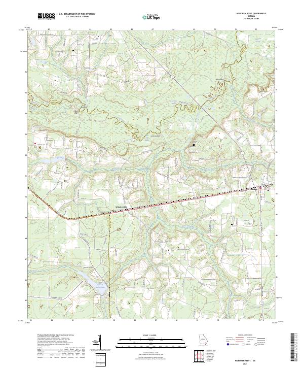
2024 Map of Hoboken West
USGS Topo · Published 2024About this map
The Satilla River meanders across the border of Brantley and Pierce counties, defining a landscape of low-lying swamp and bluffs. This section of southeast Georgia is characterized by the tight river bends of Dark Hole Reach and Blue Hole Reach, flanked by elevations like Higans Bluff and Yellow Bluff. The mapping captures the rural residential patterns of Schlatterville and Hoboken, where local life is oriented around a network of family-named roads and remote burial grounds. Genealogists can trace sites such as Enon Cem and Thrift Cem, while the southern portion of the sheet is dominated by the waters of Laura S Walker Lake and the dense Raulerson Swamp. The convergence of Mill Creek, Big Creek, and South Prong Big Creek underscores the complex hydrology that has historically shaped settlement in these pine-studded wetlands.
Find a feature on this map
130 named features on this map. Tap any name to fly to it.
Don’t see what you’re looking for? This feature index may not catch every label — zoom into the map to look around manually.
Map Details
Editions of this 2024 Hoboken West Map
This is the sole edition of this map. No revisions or reprints were ever made.
Other maps of this area

1953 · Waycross
USGS Topo · 1:250,000

1958 · Waycross
USGS Topo · 1:250,000
1966 · Winokur
USGS Topo · 1:24,000
1966 · Hoboken East
USGS Topo · 1:24,000

1967 · Waycross SE
USGS Topo · 1:24,000
1967 · Fort Mudge
USGS Topo · 1:24,000

1967 · Hoboken West
USGS Topo · 1:24,000

1967 · Waycross East
USGS Topo · 1:24,000

1971 · Blackshear East
USGS Topo · 1:24,000

1971 · Blackshear West
USGS Topo · 1:24,000