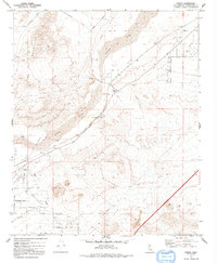
1971 Map of Hodge
USGS Topo · Published 1992About this map
The Mojave River carves a wide path through this high desert region, anchoring the small settlements of Hodge and Johnstons Corner. In the early 1970s, this landscape was defined by the intersection of traditional routes and modern infrastructure. The National Trails Highway parallels the river and the pipeline corridors, serving as a primary artery through the valley floor. To the west, the massive silhouette of Iron Mountain rises sharply, while the southern reaches unfold into the Brisbane Valley.
Find a feature on this map
32 named features on this map. Tap any name to fly to it.
Don’t see what you’re looking for? This feature index may not catch every label — zoom into the map to look around manually.
Map Details
Editions of this 1971 Hodge Map
3 editions found
Other maps of this area

1932 · Barstow
USGS Topo · 1:125,000

1934 · Barstow
USGS Topo · 1:125,000

1953 · San Bernardino
USGS Topo · 1:250,000

1956 · San Bernardino
USGS Topo · 1:250,000

1956 · Hawes
USGS Topo · 1:62,500

1956 · Barstow
USGS Topo · 1:62,500

1956 · Helendale
USGS Topo · 1:24,000
1956 · Victorville
USGS Topo · 1:62,500

1957 · Apple Valley
USGS Topo · 1:62,500

1957 · San Bernardino
USGS Topo · 1:250,000