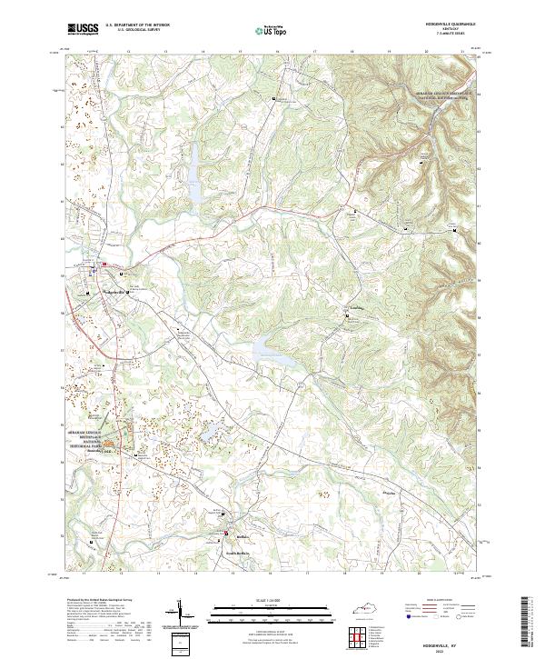
2022 Map of Hodgenville
USGS Topo · Published 2022About this map
Abraham Lincoln Birthplace National Historical Park anchors the northern and western reaches of this area, centered on the historic Boundary Oak and the early 19th-century landscape of Larue County. The settlement of Hodgenville serves as the local hub, where the N Fork Nolin River meets the road network. To the south, the village of Buffalo and its neighbor South Buffalo mark a transition toward the S Fork Nolin River, an area characterized by family farms and established rural congregations.
Find a feature on this map
126 named features on this map. Tap any name to fly to it.
Don’t see what you’re looking for? This feature index may not catch every label — zoom into the map to look around manually.
Map Details
Editions of this 2022 Hodgenville Map
This is the sole edition of this map. No revisions or reprints were ever made.
Other maps of this area

1934 · Munfordville
USGS Topo · 1:48,000

1935 · Elizabethtown
USGS Topo · 1:48,000

1937 · Munfordville
USGS Topo · 1:62,500

1938 · Elizabethtown
USGS Topo · 1:62,500

1949 · Tonieville
USGS Topo · 1:24,000

1949 · Elizabethtown
USGS Topo · 1:24,000
1949 · Elizabethtown
USGS Topo · 1:62,500

1953 · Howardstown
USGS Topo · 1:24,000

1953 · Nelsonville
USGS Topo · 1:24,000

1953 · Hibernia
USGS Topo · 1:24,000