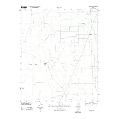
2010 Map of Hodgson
USGS Topo · Published 2010About this map
Caughorn Prairie spans the southwestern portion of this Bowie County landscape, where the flatlands meet a dense network of creek drainages. The area is defined by small, dispersed rural settlements including Hodgson, Hubbard, New Hope, and Tuckers Corner. These clusters of homes and family farms are connected by a web of county roads, such as Co Rd 4325 and Co Rd 4305, which cross the numerous tributaries flowing toward the Red River basin. To the northeast, the outskirts of De Kalb are visible, centered around the recreational and water resources of De Kalb Lake. The geography is heavily influenced by water, with Anderson Creek, Ward Creek, and Blythe Creek carving through the terrain. Genealogists may find value in the location of Cedar Creek Cemetery, a quiet landmark situated near the western edge of the survey area.
Find a feature on this map
56 named features on this map. Tap any name to fly to it.
Don’t see what you’re looking for? This feature index may not catch every label — zoom into the map to look around manually.
Map Details
Editions of this 2010 Hodgson Map
This is the sole edition of this map. No revisions or reprints were ever made.
Other maps of this area

1930 · Bassett
USGS Topo · 1:62,500

1950 · De Kalb
USGS Topo · 1:24,000

1950 · Oak Grove
USGS Topo · 1:24,000

1951 · De Kalb
USGS Topo · 1:24,000

1951 · Oak Grove
USGS Topo · 1:24,000

1951 · Avery
USGS Topo · 1:24,000

1953 · Texarkana
USGS Topo · 1:250,000

1956 · Texarkana
USGS Topo · 1:250,000

1965 · Lydia
USGS Topo · 1:24,000
1965 · Hodgson
USGS Topo · 1:24,000